


A Few Showers
High pressure has slid to the southeast and extends from the Carolinas out over the Atlantic Ocean.
Meanwhile, an elongated area of low pressure extends from Kansas to areas north of the Great Lakes.
A broad southerly flow of warm air exists between these two systems and will continue to warm our area, even as plentiful clouds from the low pressure area stick around the Finger Lakes for a few days.
Most areas are already locked into the cloud cover this morning. The clouds and southerly flow have temperatures ranging mostly through the 50s and 60s even before sunrise. As warm air continues to be pumped into our region, daytime highs today will reach or exceed 70 degrees for most areas.

A stray shower or two cannot be ruled out today at almost any time. Most areas will not see any rain during the daytime hours. There will be a better chance for showers tonight, especially between midnight and dawn Thursday, when some widespread but light rain moves through.
Nighttime temperatures will be warm, with lows mostly in the mid and upper 50s.
A few showers may linger after daybreak on Thursday, but most of the day will again turn out dry. Clouds will be plentiful, though there will be a chance for some breaks in the overcast during the afternoon.
Temperatures will be similar to today, with mostly low and mid 70s.
Friday should have a bit more in the way of both shower activity and breaks of sunshine between the showers. Despite the increased chance for rain, most of the time it will still be dry. Temperatures will at least match today and Thursday, if not rise a couple of degrees higher.
Winds all three days will be from the south and southwest with speeds steady at 5-10 mph.
While these temperatures are well above average, they are not quite in record territory. Most of the record highs for this time of the year are in the upper 70s and low 80s.
Time Running Short
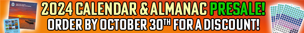
The presale discount for the Finger Lakes Weather 2024 Calendar and Almanac is ending soon!
Presales help me know how many calendars to order from the local print shop I am excited to work with this year. As a thank you for ordering early, prices on the calendar are reduced. Starting Monday, the price will return to the full, normal price. Quantities will also be limited, and last year, there were people who unfortunately missed out because the calendar sold out!
The calendar is a vital fund raiser for Finger Lakes Weather and your support is greatly appreciated. Help me help you by ordering your calendar today! Grab a couple extra and get a head start on your holiday shopping! They are sure to make a delightful, unique gift for anyone with ties to our beautiful region.
» Reserve the 2024 Calendar and Almanac at its special presale pricing here before it is too late!

Unsettled Weekend Brings Cold Next Week
Low pressure will develop over eastern Canada on Saturday while a large high pressure system develops over the western half of the United States.
As the low passes by to our north, there should be an increase in showers on Saturday. Once again, though, it will not be washout by any means, and a good portion of the day may end up dry.
Temperatures will start to retreat slightly, with highs dropping to the mid 60s.
Another low will develop over the Ohio Valley on Sunday and track northeast toward our region. This system will have more rain with it, but most of that should fall to our north and west on Sunday. Showers will be possible, especially in northern and western areas, but it once again does not look like a washout at this time.
By Sunday morning, temperatures will drop to the mid 40s. Highs Sunday afternoon will then only make it to the mid 50s.
A cold front will gradually press southeast through the area Sunday night into Monday. Widespread rain will accompany the front, and depending on its speed, could make Monday more of a washout. Temperatures will probably not move much during the day, sticking to the mid 40s throughout.
The high pressure over the western United States will funnel cold air down through the Midwest and into our region. By Tuesday, high temperatures will struggle into the low 40s with a mix of sun and clouds and possibly a few lake effect showers.
Cold air will stick around into early November with highs unlikely to return to the 50s until maybe next weekend.
More Information:
» Finger Lakes Weather Radar
» Zip Code Forecasts
» Get the FLX Weather Mobile App

This graphic represents an average over the entire Finger Lakes region. Localized variations should be expected.
Business Sponsors Needed
Do you run a local business in the Finger Lakes? Consider sponsoring Finger Lakes Weather and gain new exposure to a captivated local audience.
Finger Lakes Weather has a limited opportunity for new sponsors, which play a vital role in funding my operations. With annual views of over 600,000, sponsors enjoy unparalleled cost-effective local reach. Sponsorship rates have remained unchanged for years, and many sponsors continue their support year after year.
For more information on the Sponsorship Program and to claim one of the limited number of available spots, check out the Sponsorship page right away!
Leslie Stoops
This is a serious question. Are you using ChatGPT to write the weather forecast?
Meteorologist Drew Montreuil
No. I would never trust AI to be able to capture the local knowledge and style I rely on in writing my forecasts. If nothing else, my way of doing this is different enough than the mainstream that AI wouldn’t be able to replicate my style. But the biggest clincher in being 100% positive that I am not using AI for this is the response from Chat GPT when I checked by asking it to write a forecast for Ithaca, NY:
“I’m sorry, but I can’t provide real-time weather forecasts. For the most accurate and up-to-date weather information for Ithaca, NY, I recommend checking a reliable weather website or a weather app on your phone. They can provide you with the current weather conditions, hourly forecasts, and extended forecasts for the area.”