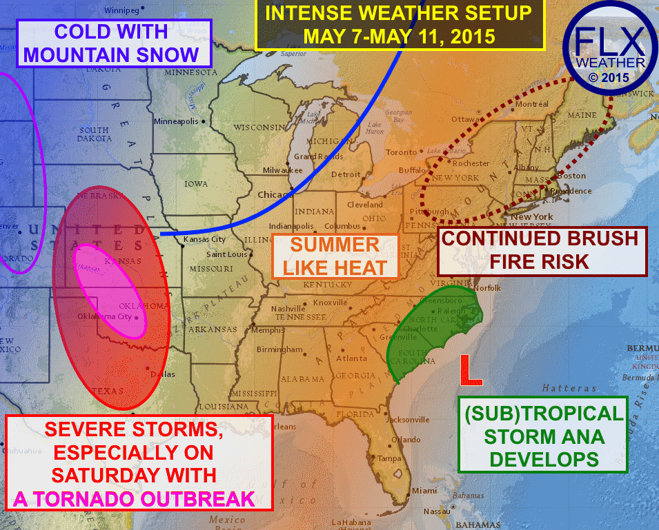
Spring is one of the most volatile periods each year in American weather. Everything is possible, and everything will be ongoing over the next few days.
Starting with the Northeast, including the Finger Lakes, the intense weather is two fold. Very warm temperatures will develop over the next few days, with summer-like heat settling in. Temperatures in the Finger Lakes should be well into the 80s Friday, Saturday and Sunday, with some of the normally warmer locations along the Lake Plain pushing into the upper 80s. I wouldn’t be all that surprised if someone briefly hits 90º even.
Along with all that heat is the continued dry weather, with only some scattered showers and storms moving in by the weekend. As a result, the brush fire risk remains elevated. A large fire continued to burn in the Catskills, numerous brush fires were sparked in Syracuse on Wednesday, and many other fires have been sparked in recent days across New England. This threat will not decrease significantly until early next week when there is a better chance for rain.
Moving to the Southeast, the concern is tropical in nature as an area of low pressure off the coast of the Carolinas is expected to develop into the first named storm of the 2015 Hurricane Season, which doesn’t officially start until June 1. This system may only become a hybrid storm, in which case it would be called Subtropical Storm Ana. If it gains full tropical characteristics, it would be Tropical Storm Ana. Regardless, some gusty winds and locally heavy rains are possible throughout the eastern Carolinas.
Shifting to the southern Plains, Tornado Alley will live up to its name with a continued barrage of severe thunderstorms. Numerous tornadoes were spawned on Wednesday across Oklahoma and Kansas, including in Oklahoma City. Severe storms will continue to be a problem over the next few days, but especially on Saturday when a major tornado outbreak is possible.
Often times when there is severe weather in the Plains, it is partly the result of some cold air over the Rockey Mountains. Such will be the case this weekend as below normal temperatures move into the northern Plains and Rockey Mountains. Snow will be possible along the Front Range of the Rockies, including possibly in Denver.
The next few days will have some intense weather across many parts of the United States. While this combination of fire-heat-tropics-tornadoes-and-snow is fascinating and uncommon, it is not unheard of and is a product of the continued transition from winter to summer that happens each year. Hopefully, everyone will stay safe and have a Happy Mother’s Day weekend.


Harvey Greenberg
Having a national weather story is quite useful. It’s rarely found on NOAA.