


Weekend Weather Forecast
A major pattern shift will take place over the next 48 hours, with temperatures on Sunday turning out about thirty degrees colder than on Friday.
Warm air will continue to reside over the Finger Lakes for one more day on Friday. Skies are mixed across the region to start the morning, and will remain mixed throughout the day.
A few scattered showers will be possible. Most areas will see little to no rain today, and those that do see rain will only see brief, light amounts.
Southwest winds will blow at 5-10 mph, like the last several days, helping ensure temperatures reach the mid 70s for most areas and low 70s in the higher elevations.
It will be another mild overnight as well, with most areas sticking to the 60s throughout the night. Clouds will gradually increase, especially after midnight.
Temperatures will only have a small window for warming Saturday morning before a cold front marches through the region. This front will have some scattered showers with it, but these should only linger for a couple of hours. By the afternoon, some sun may be starting to come out again.
Winds will turn to the northwest behind the front with speeds around 10 mph. Colder air will start to move in, and temperatures should drop to the mid 50s for Saturday afternoon.
Clouds will increase again Saturday night, but northwest winds will continue to drive temperatures down with low and mid 40s by Sunday morning.
A second weather system will impact the area on Sunday with periods of showers and rain. The rain will not be heavy, and there may be some breaks at times, but all in all it looks like another soggy Sunday.
Temperatures on Sunday will not move much from the morning lows, with highs only a degree or two warmer, sticking to the mid 40s.

Time is Almost Up!
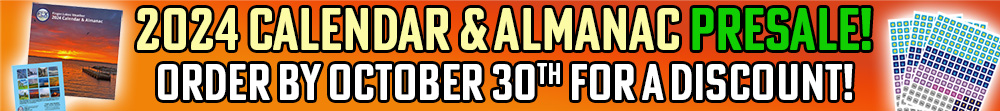
We are now in the final days before the 2024 Finger Lakes Weather Calendar & Almanac presale period ends. Monday will be your last chance to reserve your copy at a reduced price.
If you have been meaning to put your order in, but just haven’t yet… now is the time to act! You will not want to risk missing out on this beautiful, multi-function calendar and almanac. There will be a limited number available after the presale period ends!
With stunning local photos donated by FLX Weather users, monthly stats and records for six locations throughout the Finger Lakes, and a whole new set of on-grid historic weather events, the 2024 calendar is sure to bring enjoyment and functionality to every day of 2024.
The 2024 version of the calendar builds on last year’s successful first calendar. This year, I am using a local printer who has supplied a significant upgrade in paper quality. The colors are vibrant and the text is sharp. Calendars will also be shipped with a cardboard insert for extra stability, and presale shipping will begin weeks earlier than last year.
The large 12″ by 12″ size of the calendar makes it eye catching and useful, and the extra add on tracking stickers further transform it into a weather journal where you can log the year’s daily weather changes.
The 2024 Finger Lakes Weather Calendar & Almanac is unique, multi-faceted, functional, and stunningly beautiful. Get started on your holiday shopping — they make a tremendous gift!
But again, the presale period is almost over. Don’t miss out — get your order in now!

Cold Weather Stays
Rain showers will continue Sunday night and into Monday. The rain on Monday should be most concentrated in the morning and should be more sporadic than on Sunday.
With plenty of clouds and northwest winds, temperatures will continue to hover in the mid 40s Sunday night and through the daytime hours on Monday.
Skies may clear out on Monday night, leading to cold temperatures in the upper 20s and low 30s. This should be a killing freeze for most areas, though a few lakeshores may stay just above freezing.
Tuesday, Halloween, will be mostly cloudy, though a few breaks of sun will be possible from time to time. The weather is expected to stay dry, at least. Daytime highs will be in the low and mid 40s and evening trick-or-treat temperatures look to drop to the mid and upper 30s.
Tuesday night should be a bit colder than Monday night, and most areas that escape a freeze the first time around should see one by Wednesday morning.
An area of low pressure will develop along the coastal regions on Wednesday next week and could spread precipitation back into the area. While a few outlier models hint at some surprising amounts of snow, a much, much more likely scenario is for mostly rain to fall with some higher elevation snow mixing in.
Be wary of early season snow hype, but know I am keeping an eye on things, just in case, as always.
Temperatures will make a slight rebound late next week and into the weekend as temperatures claw their way back to the low 50s, but it will probably be nothing more than a short-lived rise in response to the next weather system approaching, with more cold air likely behind.
More Information:
» Finger Lakes Weather Radar
» Zip Code Forecasts
» Get the FLX Weather Mobile App

This graphic represents an average over the entire Finger Lakes region. Localized variations should be expected.
Business Sponsors Needed
Do you run a local business in the Finger Lakes? Consider sponsoring Finger Lakes Weather and gain new exposure to a captivated local audience.
Finger Lakes Weather has a limited opportunity for new sponsors, which play a vital role in funding my operations. With annual views of over 600,000, sponsors enjoy unparalleled cost-effective local reach. Sponsorship rates have remained unchanged for years, and many sponsors continue their support year after year.
For more information on the Sponsorship Program and to claim one of the limited number of available spots, check out the Sponsorship page right away!