


No Cold Behind Low
A small area of low pressure situated over Michigan this morning brought another coating of snow to the region during the early morning hours.
—
This low is embedded within a broad area of southerly winds that dominated the flow across the eastern half of the United States and Canada thanks to a large area of high pressure over northern New England.
Over the course of the day, this high will strengthen and push south while the low will dissipate.
Winds will remain out of the south throughout the day. During the afternoon, a little sun may work out as well.
The result will be temperatures near or above 40 degrees this afternoon for much of the region. The Southern Tier and Central New York will be coolest with upper 30s while areas near Rochester push well above 40 degrees.
Clouds will increase again this evening as the south wind continues and a large storm system moves into the Deep South. Overnight lows will drop back to about 30 degrees.
Edge of the Storm
As low pressure builds into the southern Appalachians on Saturday, high pressure will build into the Great Lakes, blocking the path of the storm to the north.
This should keep the region mostly, but not completely dry Friday and Saturday.
A couple rain showers may be possible Friday afternoon. Even if these do work in, they may not reach the ground before evaporating.
The best chance for rain will be near dawn on Saturday across far southeastern areas to the east of Elmira.
Temperatures Friday will rise into the mid and even upper 40s. There will be a bit of a breeze, though, especially over higher elevations.
Saturday will be a bit cooler as winds turn to the north in advance of the blocking high pressure system. Expect highs to reach about 40 degrees.
Sunday will have an increase in sunshine though thin clouds will filter some of the sun. Temperatures will again be around 40 degrees.
Temperatures Decline, then Rise Again
On Monday, an area of low pressure will cross Canada, dragging a cold front through the northeastern United States.
This front will only bring a few flurries to the region.
Temperatures Monday will retreat a little further with highs in the upper 30s. Strong winds with gusts over 35 mph will buffet the area though, sending wind chills into the 20s.
Tuesday will also be blustery and colder yet. Highs will only manage to reach the mid and upper 20s with colder wind chills.
High pressure will be overhead though, so any response from the lakes will be squashed. Skies will be partly cloudy with no snow expected at this time.
Warm air will return on Wednesday with highs around 40 degrees. More 40-degree warmth is expected late in the week.
Our chances for a White Christmas may then rest on a late week storm system next week, but it is far too early to speculate what that system may bring if it even makes it this far north.
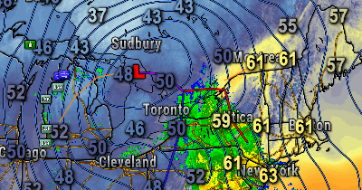
New Map Pages
Check out two new map pages- the satellite page and surface map page!

John Gregoire
That sat imagery certainly shows the sources of light pollution! Be neat if all this will be accessible from the blog page. Appreciate the additions.